Forging a Self-Governing Community
An Interview with Tom Gray and David Howerton
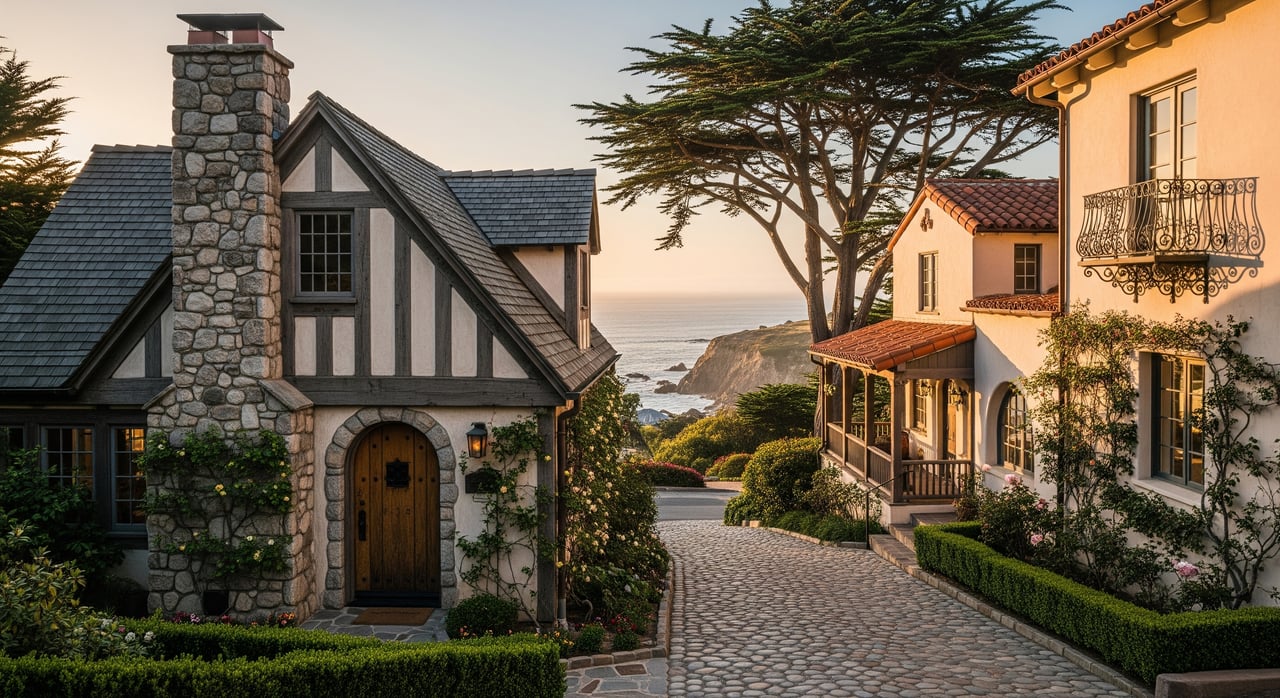
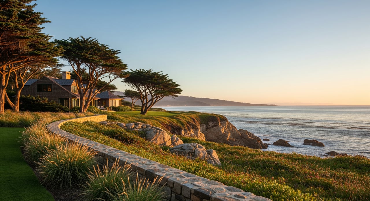
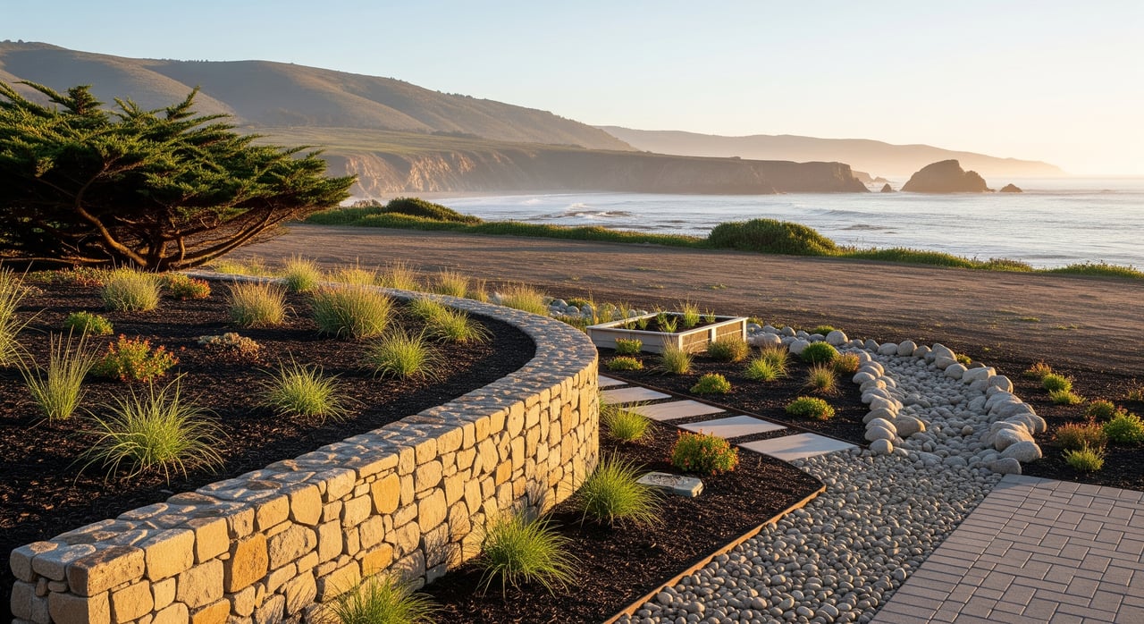
Throughout history, people have gravitated to places of great natural beauty, temperate climates, abundant natural resources, wondrous wildlife, ease of access, and a sense of safety. The 31 square miles of the Santa Lucia Preserve in the coastal foothills and valleys of the Monterey Peninsula has been such a place since the Rumsen Ohlone Indians settled here 15 centuries ago.
Generation after generation, Rumsens made the easy round trip from their village, Echilat, on the central plain of what is now Santa Lucia Preserve, to Carmel Bay to fish and gather mussels. After Father Junipero Serra founded the Mission San Carlos Borromeo in 1770, the Echilat Rumsen were forced into servitude at the Spanish Mission, and Echilat was abandoned. By the time of Mexican independence in 1821 and the formation of land grants, European diseases to which the Rumsen people had no immunity had severely depleted the tribe.
For the next 170 years, the land remained a time capsule of a quintessentially Central California landscape. The expanse of two large Mexican land grants fell through time, touched only by livestock grazing and dry farming. (Well, there was an interlude in the 1920s for some Gatsbyesque polo matches.)
The next, and last, era began in 1990 when Tom Gray, his late partner Peter Stocker, and their partners purchased the historic 20,000-acre Rancho San Carlos with a vision to protect a rare treasure of natural landscape. They engaged land planner Dave Howerton to help implement the vision.
Preserve interviewed Tom and Dave for a discussion of their original vision, the process of seeing it through, and the future of what has become a living dream.
What was the original vision behind the land plan for the Preserve?
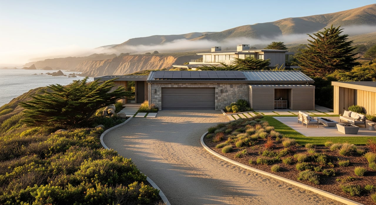
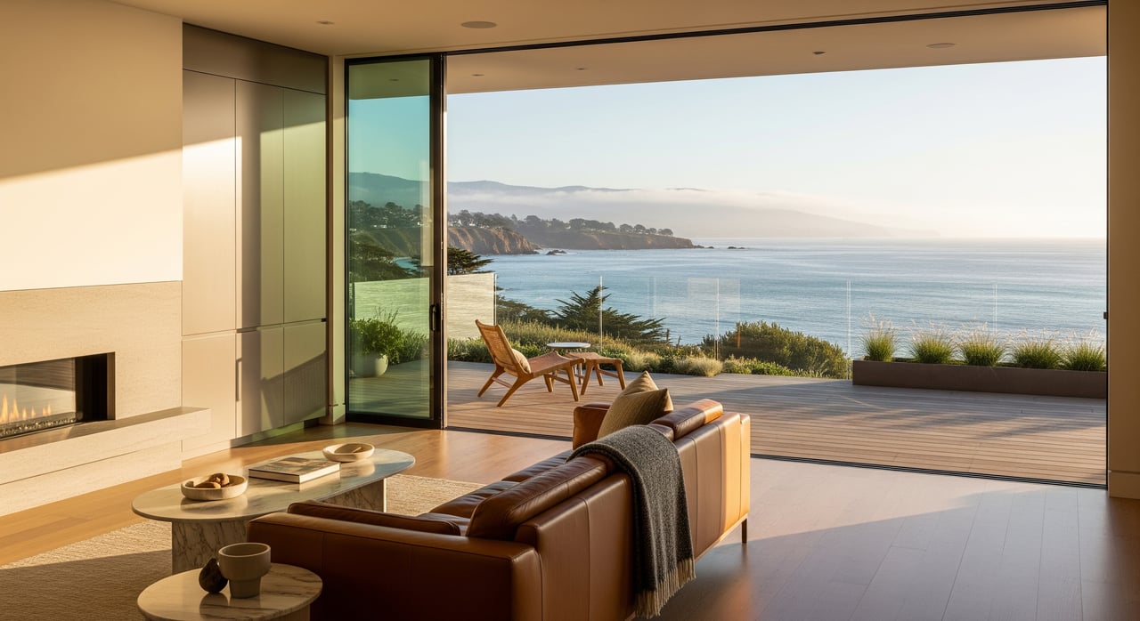
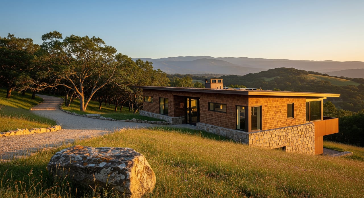
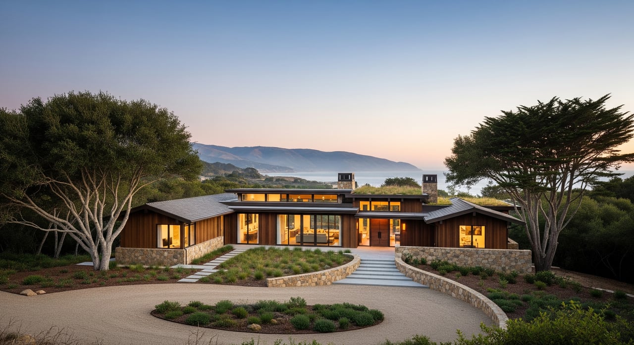
If we hadn’t seen it ourselves, we would never have believed that such a spectacular, yet unknown, landscape could exist in the last decade of the 20th century within 30 minutes of Carmel-by-the-Sea and Pebble Beach. We were awe-struck by this miracle and suffused with responsibility for the stewardship of this treasure. No place like it existed in California, perhaps in the world — the unique, almost untouched, combination of scale, perfect climate, forested 2,500-foot ridges, verdant valleys, creeks, savannas, redwood and oak forests, abundant wildlife — all within reach of the world-renowned Monterey Peninsula.
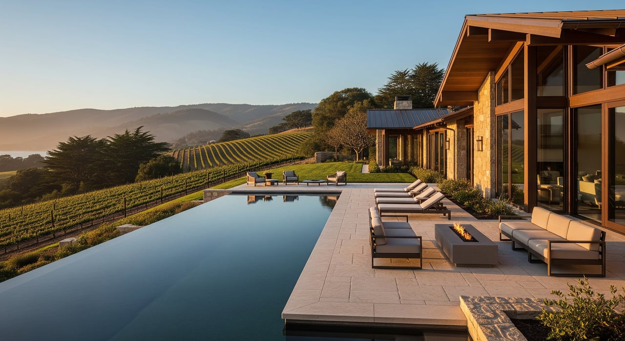
On first sight, we realized the enormous responsibility to protect this grand landscape for ensuing generations. The value was in the “whole of the landscape,” not in its parts sliced into hundreds of individually managed parcels. Rather than the usual development plan, we needed to invent a new concept of land planning. We set as our goal a community of 300 families settled and committed to being stewards for the whole 20,000 acres—for the benefit of their children’s children and beyond. We would form a private national park and a sustainable community in one. We wanted to create a model for long-term and large-scale resource conservation for the nation and the world.
What process did you use to develop such a visionary land plan?
We followed the mandate of the late landscape architect Ian McHarg, a pioneer in ecological planning, especially his Design with Nature. His mantra: Begin with the land. We had to break down this majestic landscape into its components, the natural resources which combined to make it beautiful and rare. The approach made environmental and economic sense. These resources were the value, the assets, that our settlers would want to buy and protect. For six years, an army of ‘ologists’ scoured the landscape to prepare rigorously researched, comprehensive, scientific evaluations of natural and scenic resources. In 1990, no private landowner, let alone a developer, had ever undertaken such an effort.
We used a Geographic Information System (GIS) to map the findings from these studies. This process allowed us to integrate, display, and analyze all forms of geographical information in digital form — the watersheds, wetlands, wildlife and riparian corridors, redwood and oak forests, environmentally sensitive habitats, and historic resources. Concurrently, we scouted the 20,000 acres for every spot with a sense of place for a home, (We also found poison oak; for two years, Cortisone was our best field tool.) We drove 500 stakes in the ground and recorded their locations on the GIS map. Then we sandwiched these locations with all our layers of resource information to isolate the places where homes would have the mildest environmental and scenic impacts.
A clear pattern of land use revealed itself — 18,000 acres suitable for conservation (the “Preserve Lands”) and 2,000 acres appropriate for settlement (“Settled Lands”). We called our approach “high-tech and high-touch.” Out of this process came a fresh perspective on land planning, one that incorporates human settlement as an integral part of a healthy rural ecosystem along with a system of governance that sustains the integrity and biodiversity of the landscape. The key to the success of this plan is the independent, nonprofit Santa Lucia Conservancy, founded to guarantee, through conservation deeds and easements, that the lands of the Santa Lucia Preserve will be managed and protected in perpetuity and never subdivided further.
How do you define a Community Preserve? Is this concept proprietary to the Santa Lucia Preserve?
Since the turn of the 19th century, extremely wealthy families, such as the Vanderbilts, acquired majestic landscapes across America to save and enjoy. Some of these protected places evolved to become legendary and irreplaceable communities; some are national and state parks. Similarly, we hoped to create a 21st-century opportunity where families would live in and protect one of California’s exceptional natural places — “a community within a preserve.”
We trademarked the concept as Community Preserve™, defined as “A permanent preserve dedicated to a conservation trust, which contains significant native plant and wildlife habitat and is financially and philosophically sustained by a limited residential community on the least environmentally sensitive lands.”
The 300 families who have settled within The Preserve will help steward a 20,000-acre private land preserve under the watchful eye of the Santa Lucia Conservancy. There are successful examples of conservation of large landscapes with little or no settlement. The Nature Conservancy and similar nonprofits are quite successful at these efforts. And there are a few small examples where homes have been integrated to fund the protection of landscapes, but we don’t know of an analog for a Community Preserve™ of the scale and complexity of the Santa Lucia Preserve. If it is not unique, it is certainly rare.
The Santa Lucia Conservancy is key to the ongoing success of managing the protected lands at The Preserve. How does it work?
We created the Santa Lucia Conservancy as a nonprofit, tax-exempt, and legally independent conservation trust. The Conservancy ensures that the Preserve Lands remain natural and protected in perpetuity and never subdivided or further developed, and it provides stable and consistent management of the shared Preserved Lands. We partnered with the Trust for Public Land, which saw Community Preserve™ as a new model for conserving large landscapes with private funds.
The Conservancy also provides scientific, educational, restoration, enhancement, and management programs that test the Community Preserve™ model. Many conservation models fail for financial reasons. It’s far easier to raise money to acquire land than it is to maintain and protect it. We sought to ensure that the Conservancy could fund its programs without relying on contributions from The Preserve homeowners. Instead, a permanent $30 million endowment established by contributing a portion of the proceeds from the sale of each residential homesite supports the Conservancy programs.
Today, The Preserve, which is equal in size to the entire Monterey Peninsula, is the largest privately-owned and fully endowed contiguous preserve in California. We can all be proud of that.
What were the most challenging parts of the land planning and approval process?
The nadir arrived in the second half of 1996. Our financial partner defaulted on its capital call and attempted to sell the land out from under us. If that wasn’t bad enough, we had to fight two lawsuits claiming that The Preserve did not comply with the County General Plan and that our Final Environmental Impact Report was defective. The future of The Preserve faced a County-wide vote. On the ballot, all our thoughtful, scientific, and detailed planning was reduced to the words “Do you approve of the Santa Lucia Preserve subdivision — yes or no.”
We ran a full-on: campaign — TV ads, 300,000 direct mail pieces, print ads, and 150,000 personal phone calls. We lost by five percent, the usual margin in an even race when you have the “yes” side of the ballot. Voters who don’t know — everyone in the County except those on the Peninsula — tend to vote “no.” Still, we lost the battle but won the war.
Despite the loss at the ballot box, in 1997, the County Board of Supervisors reapproved The Preserve with only minor changes. However, we were broke and in litigation with our financial partner. Soon, though, the power of this landscape and our commitment to its protection won out. That same year, 1997, we recapitalized the Partnership and bought out our old partner. The Preserve survived.
Founding an out-of-the-box community is a daunting task. There were no comparables, no maps to follow, and the concept truly defines intricacy. Creating The Preserve required solving a large set of equations comprised of environmental formulas, regulatory rules, political dynamics, product designs, construction costs, market pricing and timing, water availability, traffic congestion, financial returns, and on and on. We had to solve all aspects at the same time, balance the variables, go through numerous iterations that lead to compromise, and apply to the County for entitlements. Unfortunately, our critics — some politicians, oddly some environmentalists, but also our original financial partners — expected their preferred formula to be solved first and perfectly. The negotiations to reach sensible answers were intense and time-consuming. Amid the chaos, the challenge was to stay true to our vision.
The Monterey Peninsula has challenging political and regulatory environments. The Preserve was the largest private landholding in Monterey County, which was our greatest asset and our greatest liability. It was naive to think that because we were going to create an 18,000-acre preserve anti-growth activists would embrace us. And, the entitlement process is designed to be adversarial, not to differentiate between thoughtful and thoughtless development. The Preserve’s public record was 16,000 pages long, and yet the Plan for the Preserve became highly controversial and was constantly on local TV and in the press. Even though 300 homes scattered over 31 square miles equates to 11 homes in the one-square-mile that comprises Carmel-by-the-Sea, protests blasted our project as a “big development” by a “San Francisco” development company.
Tom and his wife Alayna moved to The Preserve and earned the trust of the neighbors, the environmentalists, the regulators, and the politicians. A small cadre of crazy believers, particularly Brian Finegan, Denise Duffy, Don Wilcoxon, and Lisa Guthrie, would not give up until we all succeeded in protecting this exquisitely valuable landscape. Our efforts worked because we worked hard, didn’t lose faith, and because Community Preserve™ is a brilliant idea for a new lifestyle that families want.
Looking back, is there anything you would have done differently?
We got the land plan and the land trust structure right. After 30 years, the landscape is healthier than it was in 1990. The Conservancy has a $30 million endowment and an unparalleled staff of environmental scientists and land managers. Extraordinary conservation-minded families purchased the lots and formed a friendly, vibrant community. However, we did not hold back enough reserves to assure that the Partnership could fulfill its obligations through the deep 2008–9 recession. We were not able to sell the last few lots and Club memberships in time to pay for the last two percent of our promises. The Partnership was insolvent; and then, the community rallied.
A Transition Committee of thirteen engaged owners undertook to plan the turnover of the partnership’s asset and ongoing governance and management to the homeowners. The Committee was transparent. It encouraged community input, held town hall meetings, and distributed a White Paper to the owners that provided an excellent roadmap.
The Committee also did not foresee the depth and duration of the 2008-9 recession, making the turnover process difficult. The crucible, while stressful, produced a vibrant, committed community of friendship and self-governance.
This process forged an elegantly complex representative democracy to govern the Preserve, which was adopted by the Community in 2008. Five elected oversight boards govern five entities — the Owners Association, the Community Services District, The Ranch Club, the Golf Club, and the Conservancy — each with discrete responsibilities. Each entity appoints a member to an overarching Preserve Board, and these five board members elect three at-large members to complete an eight-member board. The Preserve Board oversees the Preserve Company, coordinating the operations and budgets of the four entities and resolving any Preserve-wide conflicts. To assure seamless operations across all Preserve entities, a single operating unit, the Preserve Company, employs and manages the teams that provide the services to four of the five entities. (To ensure its independence, the Conservancy reserves control of its employees).
If you read the 1994 Plan for The Preserve, which is a synopsis of The Preserve’s four-volume subdivision application, you will be amazed that The Preserve today is almost exactly as described in our 1994 application to the County. Our long-range financial forecasting fell short. However, our long-range vision for a Community Preserve™ was amazingly prescient.
Looking to the future, what concerns do the homeowners have regarding the ongoing stewardship of the lands at The Preserve?
Our planning horizon was 200 years. We asked ourselves what steps taken in the 1990s would look like 200 years in the future. In 1991, we visited several 100-year old communities, most notably Tuxedo Park in Orange County, New York, founded in 1896 as a Gilded Age competitor to Newport, Rhode Island. Our observations were not astounding. We learned that financial crisis changes land use plans and destabilizes communities, that multi-generational perspectives create transitional conflict in both governance and economics, that architectural trends can wreck design guidelines and create landscape havoc. We learned that our Preserve Community™ must continuously guard against unintended and difficult evolutions that might undo the Plan for The Preserve.
Communities are difficult to self-govern. The owners must identify and elect leaders who will ensure a transparent democratic process and be willing to take stands to protect The Preserve’s vision and values. The owners must ensure that the Preserve Board and the respective entity boards follow their bylaws and fulfill their fiduciary responsibilities with complete transparency. For success, The Preserve must be governed with the advice and consent of the community. The richness of the community’s culture depends on retaining institutional memories, customs and courtesies, and history and mythology.
The Preserve survived its birth and learned lessons through its adolescence. At 25, it is healthy but not fully grown. There are enough homes, enough community, and enough activities to sustain it. How fast will The Preserve reach maturity? We are watching, with pride, as it moves into our dream of a legendary, timeless, irreplaceable, and priceless Community Preserve™. It will fulfill the prescient words of Richard Louv in his enticing book The Nature Principle: Reconnecting with Life in a Virtual Age, “What could our lives and our children’s lives be like if our days and nights were as immersed in nature as they are in technology?”